A gentle breeze carries the crisp scent of alpine grass, while the first light of dawn unveils a hushed landscape. Set in the Karawanks, Begunjščica Peak is the highest point, with a grassy summit at 2,060 meters. From here, the views unravel like a painting, stretching across Slovenia and Austria.
Some mountains invite adventure, but Begunjščica invites rest and reflection. It stands apart from well-known peaks like Triglav or the Julian Alps, cherished by hikers for its calm, steady presence. Free from the distractions of popularity, it offers a rare sense of peace.
Begunjščica welcomes every hiker, whether you seek altitude or a slower pace to reconnect. Even in busy times, its trails grant space and silence, letting you walk without rush. Solitude, fitness, or wonder—whatever drives you, Begunjščica offers true peace, inviting you to find your story in its serenity.
Some mountains demand ambition; others invite rest. Begunjščica is among the latter. Less known than Triglav or the Julian Alps, it’s respected by hikers. Photogenic and calm, it escapes the noise of popularity. This makes it special. Whether you are an experienced hiker or simply searching for a slower weekend in nature, Begunjščica welcomes you. Even in high season, its trails offer space, silence, and the rare luxury of walking without hurry.
As autumn settles in and the mountains begin to quiet down, the list of stories waiting on the Trek Goat slow travel blog quietly grows. Each hike is chosen with care and shared without haste, because slowness here is not a pause; it is a virtue. With every step, the soft rhythm of boots brushing through dewy grass gently shifts the pace, inviting calm, attention, and reflection. I remember a particular moment when, pausing to catch my breath, I noticed how the sunlight filtered through the trees, casting patterns on the ground. It was then that I truly felt my pace slowing, allowing worries to fade with each step. It is in this slower tempo that some paths stay with us longer than others. One such path leads into the wide, open slopes of Begunjščica, a circular hike that became one of my most memorable journeys in Slovenia, and the story that follows.
A broad-shouldered beauty of the Karawanks
Rising gently within the Karawanks, Begunjščica stretches its grassy shoulders to 2,060 meters. From its ridge, views open across Slovenia and Austria. The ridge runs from Smokuška Planina in the west to Sveta Ana above Ljubelj in the east. It forms a natural balcony between two worlds. Legend has it that Begunjščica was named after a mythical shepherdess. With her enchanting songs, she could calm turbulent mountain winds. Her melodies, still whispered by the breezes, tell stories of harmony between the land and its people. Today, the soft clanging of cowbells and the laughter of hikers echo through these slopes, weaving the ancient lore with the rhythm of present-day life. This juxtaposition keeps the legend of the shepherdess alive, blending with the memories of modern travellers.
Begunjščica consists of three peaks: the central Veliki Vrh (2,060 m) is the highest. Begunjska Vrtača (1,997 m) is to the east. Srednji Vrh sits to the west, just below the 2,000-metre mark. The mountain lies north of the village of Begunje, after which it is named. It is defined not by drama, but by openness.
Despite its easy southern access and panoramic trails, Begunjščica never feels crowded. The gentle southern slopes contrast with the steep northern side, typical of the Karawanks. Unlike peaks bustling with visitors, Begunjščica lets you pause, breathe, and connect with the mountains. Its scattered huts, especially Koča na Planini Preval and Roblekov Dom, offer tranquil resting places and amplify the quiet beauty of this summit.
Begunjščica is made for slow hiking. The path from Ljubelj is filled with sensory details that guide you along a tranquil journey. Each step on the gravel sends a soft crunch echoing through the air, while the scent of pine and wildflowers brushes across your senses. The gentle rustling of the breeze through the trees becomes your guide, inviting you to slow down and savour the serene beauty around you. With tunnels, pastoral huts, and wide horizons stretching ahead, this route smoothly transitions you toward the beginning of your mindful hike.
Ljubelj Pass: where the hike begins
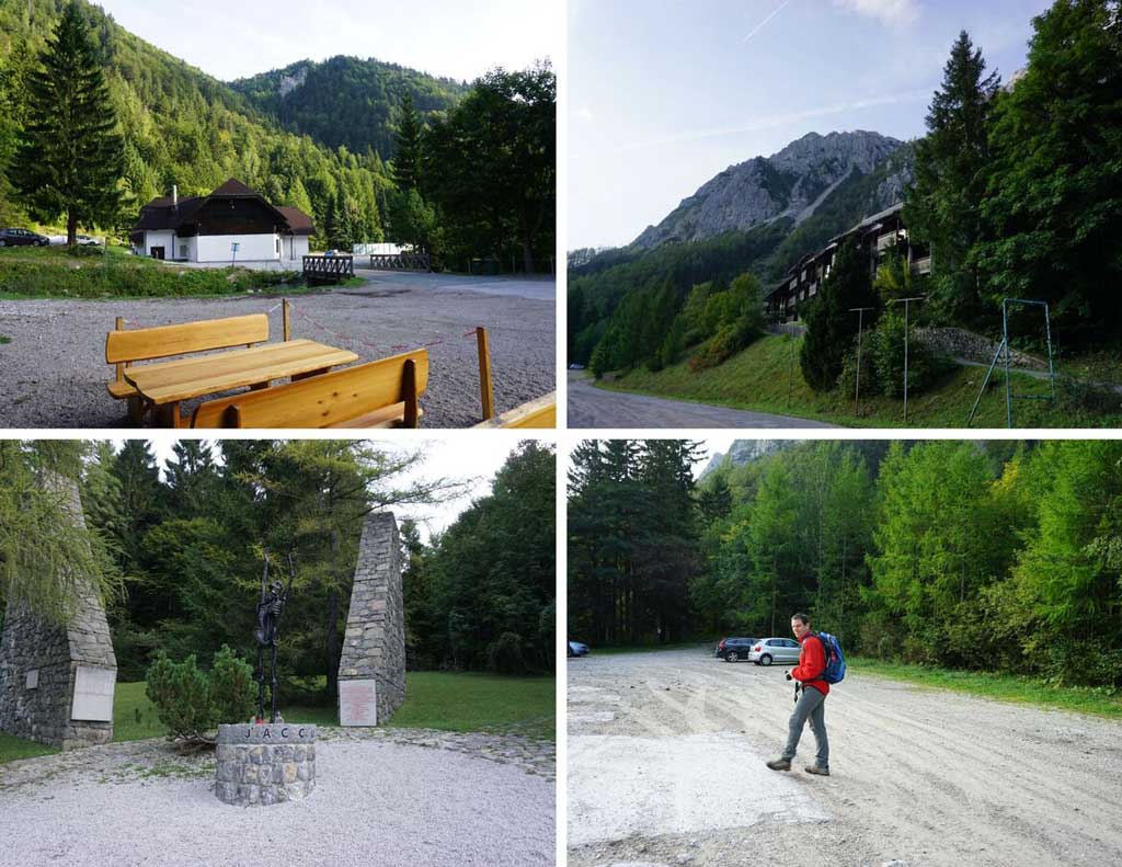
Ljubelj Pass is more than just a border crossing between Slovenia and Austria. At 1,369 metres above sea level, it is a well-known starting point for hikers heading into the Karawanks. Even in early spring, the trails remain safe, offering a secure footing when snow lingers. As I approach the long road tunnel, which stretches 1,570 metres in length and marks the boundary between the two countries, I switch on my headlamp. The glow cuts through the darkness, illuminating the cold, damp walls that carry whispers of history, their construction dating back to World War II. Running my fingers along the cool stone, I feel as though I’m momentarily walking alongside those who once labored here in a different era.
From the large parking area at Ljubelj (1,058 m), follow a wooden sign marked “Planina Preval.” This marks the start of the circular 17 km route: Ljubelj – Planina Preval – Veliki Vrh – Roblekov Dom – Završnica – Ljubelj. The full loop involves about 1,632 m of ascent and 1,628 m of descent. Expect most hikers to complete it in 7 to 9 hours, with Planina Preval reached in 2 to 2.5 hours and Veliki Vrh in 3.5 hours from the start, depending on pace and breaks.
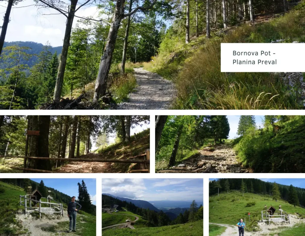
Through forest and tunnel: Bornova pot
The trail initially follows Bornova pot, named after Julius Born, who built the tunnel in 1891 to access his hunting grounds. You’ll reach the tunnel approximately 15 minutes from the start at Ljubelj. The tunnel is narrow, dim, and about 30 meters long—bring a headlamp for this section. The ceiling is low in places, puddles gather underfoot, and the air is cool and damp.
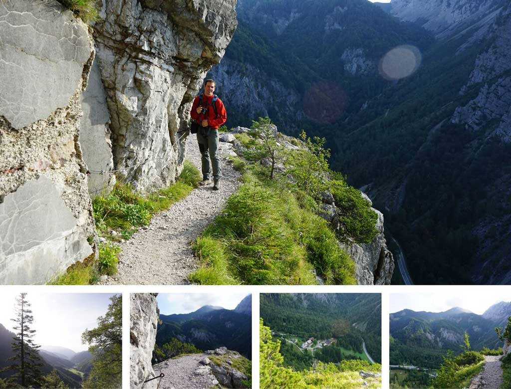
On the far side of the tunnel, the trail emerges onto the eastern slopes of Begunjščica and traverses steep, forested terrain for roughly 40-50 minutes before gradually gaining height. You will reach a marked junction with the Podljubelj trail after about 1.5 hours from the start, leading you onward to Koča na Planini Preval. Forest, silence, and the quiet Alps set the atmosphere for a slow ascent.
Planina Preval: milk, meadows, and stillness
The Preval saddle, reached after roughly 2 to 2.5 hours and 600 meters of ascent from Ljubelj, lies on the southwestern side of Begunjščica. It serves as a crossroads of trails: continue north to Veliki Vrh, west to Roblekov Dom, or east to Dobrča and the Draga Valley. Koča na Planini Preval lies immediately south of Begunjska Vrtača.
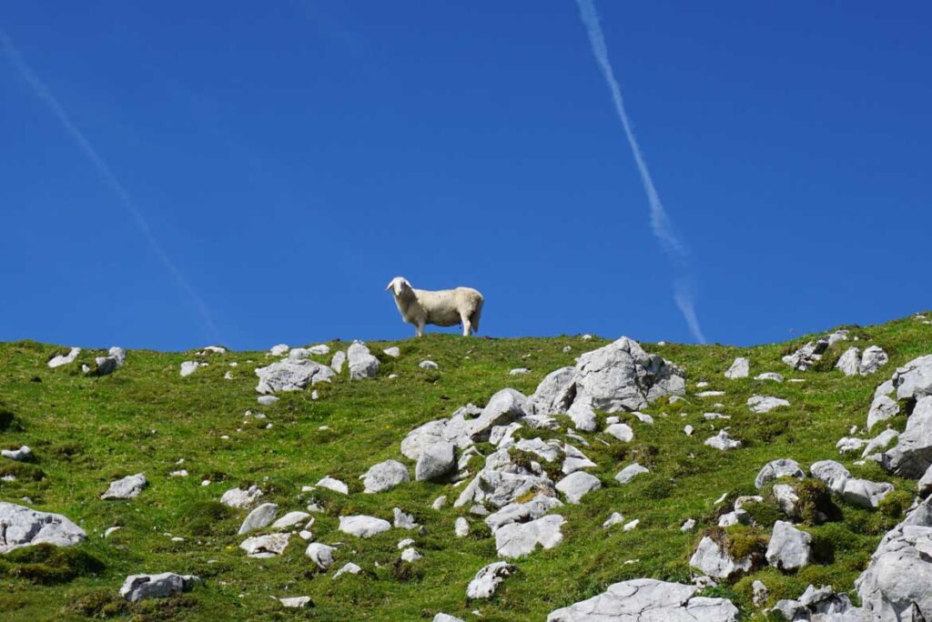
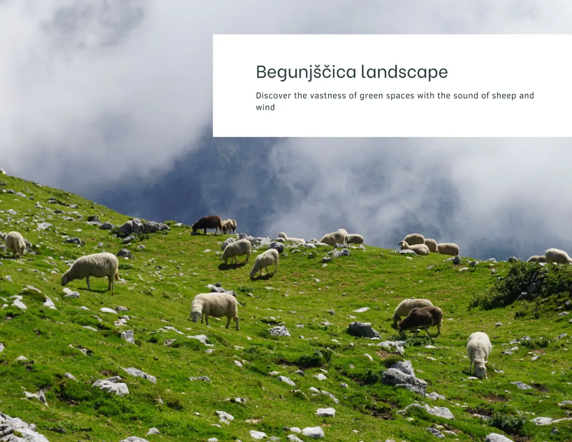
The hut has been lovingly restored. It is among the few alpine pastures that allow year-round livestock grazing. Fresh milk, sour milk, cheese, cheese štruklji, and pancakes are all made on site. Sheep and cows graze nearby as part of daily mountain life, not for show. Yes, they are Trek Goat’s friends.
This is not a place to rush through. It’s a place to sit, breathe, and let the mountain settle into you.
From Preval to Veliki Vrh
From Preval saddle, take the marked trail north, crossing Kalvarija. After about 15 minutes, grassy slopes give way to forest, where the path steepens. This segment to the forest’s edge lasts about 40 minutes. In late summer and autumn, mushrooms line the route, marking the next trail change.
As the forest thins—about 30 minutes after entering it—the trail climbs through patches of dwarf pine and steep, grassy sections that need attention. After passing a small gully (noted by a memorial, reached in about 10 minutes), wide pastures of grazing sheep open around you, and the sense of space grows with each step.

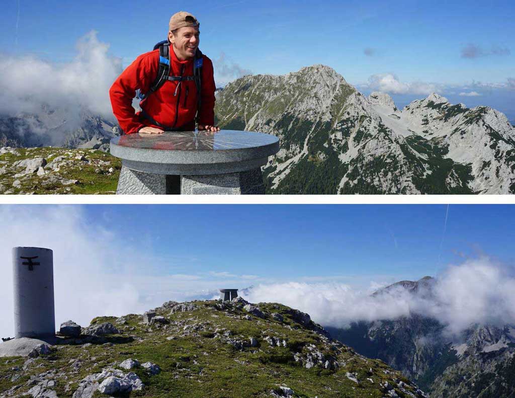
Within 45 minutes from the forest’s edge, you reach the main ridge of Begunjščica. To the north, Austria unfolds beneath your feet. To the south, green Slovenian valleys stretch outward. The ridge widens, the trail softens, and after a 10-minute final climb, you stand on Veliki Vrh, 2,060 m, with panoramic views in every direction.
From Ljubelj, the well-marked trail rises steadily to Veliki Vrh, covering roughly 7 kilometres and gaining 1,200 meters in elevation. Expect the ascent from Ljubelj to Veliki Vrh to take about 3.5 hours with breaks. The overall hike emphasises enjoying the landscape rather than speed, with each route segment clearly signed.
Veliki Vrh to Roblekov Dom
The descent crosses the summit toward Roblekov Dom. The trail winds gently, then drops through grassy slopes and forested switchbacks. After about an hour, the hut appears from the west. As you approach, the soft hum of conversations and laughter drifts through the air. Inside, a group of hikers gathers around a wooden table, hands cradling steaming mugs of tea, their faces animated as they share stories. “I almost stayed on the ridge forever,” someone laughs.
Another responds, “The view was worth every step.” The warmth of the wood stove, mingling with the scent of freshly baked bread, envelops the room in a cozy embrace. Roblekov Dom, rebuilt after being burned down during World War II and later modernized, has retained its welcoming spirit. Yet its most striking feature remains unchanged: the view over Lake Bled. Benches below the hut invite you to sit, breathe alpine air, and watch the world far below.
From Roblekov Dom to Završnica spring
The trail continues with a steep descent through dense forest. After roughly an hour, you begin to feel your legs vibrating with every step, as if they were singing like taut strings under the pressure of the journey. A junction appears, marked for Tinčkova Koča and Dom pri Izviru Završnice. Follow the latter, and the forest opens into wide meadows. You pass a spring with a fountain. Soon, you reach the hut beside the Završnica stream.
Dom pri Izviru Završnice
The hut stands at 1,425 metres on Smokuška Planina, below Begunjščica and Vrtača. Built in 1952 near the source of Završnica Creek and restored by the Žirovnica Mountaineering Society, it now serves as a peaceful refuge.

Cold water flows nearby. Silence returns. It’s an ideal place to pause—hands in the stream, boots off, thoughts quiet.
Via Zelenica back to Ljubelj
The final section gently leads to Zelenica Lodge along an easy, well-marked trail. Fatigue arises here, the kind that follows a day outdoors with a total walking time of 7 to 9 hours. Many hikers would split this route over two days, staying overnight in one of the huts. Consider spending a night at Dom pri Izviru Završnice to truly embrace the slow-travel ethos. This flexibility allows hikers of varying energy levels to savour the journey at their own pace.

Zelenica Lodge, dating back to 1929, sits on a small plateau below the Austrian border. We arrived just as the last light touched the peaks. After a brief photo break, we began the final descent.
A wide gravel path led us back to Ljubelj in about an hour. The circle closed.
Technical details – Ljubelj – Begunjščica – Ljubelj
This route, in my view, is one of the most beautiful in the Karawanks. Hospitable huts, wide meadows, quiet forests, and far-reaching views come together in a way that feels complete. Begunjščica is not about conquest. It is about movement without pressure, about layers of green and stone, about air that clears the mind.
When you return to the valley, you may not remember every step—but you will remember how it felt to walk between sky and grass, slowly, as the mountain intended. Take that memory and let it inspire your own journey: plan your hike with intention, commit to a slower pace, and experience Begunjščica for yourself. Challenge yourself to go slower—feel, connect, and stay linked with nature.
- Starting point: Ljubelj
- End point: Ljubelj
- Total ascent: 1,632 m
- Total descent: 1,628 m
- Lowest point (start): 1,058 m a.s.l.
- Highest point: Begunjščica (Veliki Vrh), 2,060 m a.s.l.
- Distance: 17 km
- Season: Spring to autumn; winter ascents are best accessed from Planinski dom na Zelenici